
February Early Look

Just like the first two months of winter is trending, February will probably be divided between temperatures. However, it all depends on a couple of important factors. This is an exclusive article where I share it everyone, even non-paid subscribers so you see what paid subscribers get. It is only $5 or $7 per month, depending on the tier.
The second half of January continues to look colder than normal for most areas east of the Plains, and it continues to look active, especially on the clipper side. The big question is, will this continue into February? With the long-range model guidance we have, they say no, but then flips back as we go into the middle of February. It kinda seems like this winter pattern is on a cycle in the upper-air pattern and it is because of the polar vortex.
For February, especially early February, the biggest factor is the EPO (Eastern Pacific Oscillation). Ridging has been hard to come by in the Gulf of Alaska over the last few weeks, keeping any cold/arctic blasts short-lived. We finally get some ridging in the Gulf of Alaska over the next couple of weeks, and it will lead to a sustained colder and more active pattern beginning the middle of this week. That’s important with February. If you look at the euro weeklies however, the ridging breaks apart quickly in the first week of February before coming back in the middle of February. Looking at the teleconnection from euro weeklies, it is neutral for the most part heading into much of February because the green line is close to the black line.
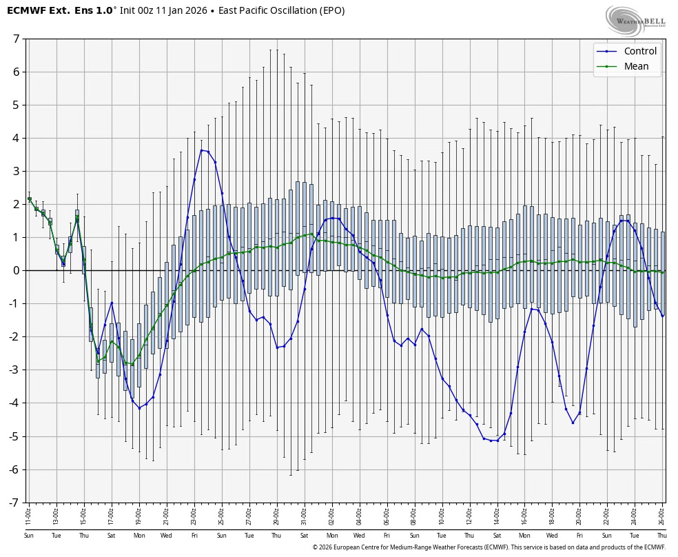
There will be periods of arctic air later this week and next week because the EPO quickly dips. If we go by just this teleconnection, which we won’t, February would have the potential to start warmer than average but trending colder than average in the middle and end of February.
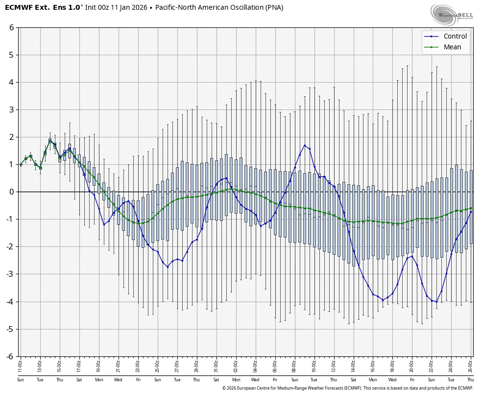
Another factor is the PNA (Pacific North American) teleconnection, because it can tell us what kind of flow we may get. We will be in a positive PNA the rest of January for the most part, keeping us in a northwest flow, but very cold northwest flow because of the negative EPO. You see how things are coming together now? The PNA starts positive in early February before trending negative deeper into the month. If it verifies, then the troughing would be centered further west than east in the second half of February. Take a look!
I’m going to skip over the last couple of factors in this article and wait until the next one. Below I will share the temperature anomalies for the month of February from the euro that I think is probably the most likely solution, especially if early February does trend warmer.
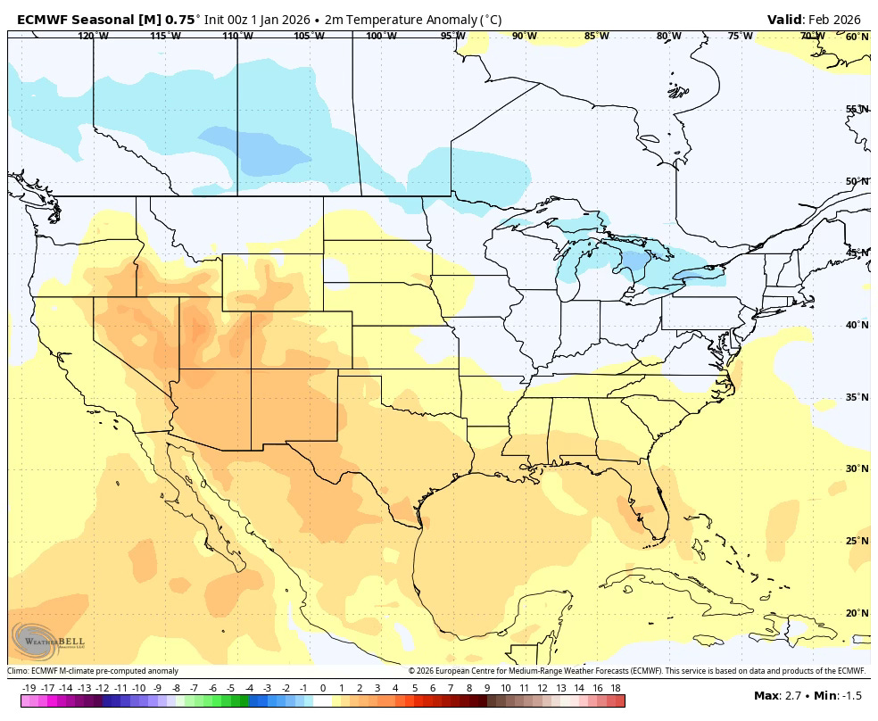
There isn’t a clear solution for temperatures from average because of the divided month. However, if the teleconnections do come together at the right time, I would assume in the next update from this model run, would trend colder some for the Central and Northern Plains. Though, arctic air has been hard to come by in the Plains this winter.
Thanks Lane! This temperature information about February is very interesting 🙂